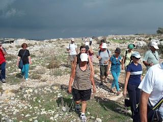
Although the first walk after the summer break was quite challenging, at 0830 more than 80 ramblers were waiting impatiently at the meeting point, eager to start walking. After a brief introduction by the secretary, all the group headed towards Wied ic-Cawsli and eventually passed through Wied il-Kbir, stopping for a very short break near Ghar Hanzir. At this point, the valley system bifurcates into two, with the one on the right leading to Wied Qirda. We took the left fork, leading eventually to Wied Xkora.
Walking practically on the valley-bed, we passed through Wied Sillani and Wied Musa, and struggled through the final stretches of Wied Xkora till eventually we reached the final point of the Siggiewi by-pass, where we had a well-deserved rest.
Then we continued upstream, passing through lesser-known valleys such as Wied ta' Manduca and Wied San Lawrenz (the most difficult & tiring slope - in the vicinity of the Laferla Cross). Then we walked through a beautiful garigue area, leading to the Gebel Ciantar cliff edge overlooking Fawwara and the Migra Ilma areas.
Here we stopped for another rest, whilst observing the scenery.
Afterwards we descended again towards Siggiewi, passing in the vicinity of Wied Zikku, and visiting two wayside chapels on our way back -tal-Providenza and ta' Hal Xluq. Following an almost unknown footpath, we reached Wied Xkora again and headed directly towards the main village square.
This was quite a 'difficult walk' bearing in mind that we started practically at sea level and reached a point approximately 250m ASL, and also that the terrain was not that easy for long stretches of this walk. However, this shows the determination of our members!
Walk leader: Simon
Duration : About 5 hours
Distance : 17 kilometres
Some of the photos below are courtesy of Silvan Mugliett
 Ghar Hanzir
 Alex, explaining the way forward
 Wied Sillani


Hal Xluq Chapel

1 comment:
I would appreciate any further information about the Chapel of San Lawrenz. Thank you.
Post a Comment