Friday, 30 October 2009

Cry, the beloved countryside

Cry, the beloved countryside*

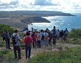
The pathways at Ta' Baldu, which are government-owned have been landscaped with hard stone and access to them barred. Photo: Alex Vella/Malta Ramblers Association.

The onslaught on the countryside has continued unabated as the law is breached with impunity in various parts of the island, according to Lino Bugeja, president of the Ramblers Association of Malta.

Together with Mr Bugeja and another two members of the association, we had gone to Ta' Baldu on the way to Simblija near Dingli. These agricultural and historical gems are two of the highlights of one of the treks the ramblers organise annually.

Ta' Baldu contains various archaeological and rural remains. Beneath several farmhouses are a number of caves one of which incorporates a system of irrigation with water gushing from a spring. The date 1629 is inscribed on one of the walls.

Nearby, a string of rubble walls of excellent workmanship rise up to five metres.

A farmer who owns part of the land said that when she once asked her mother who had built these exceptional walls, the answer she got was: "They were built by the devil in three days".

At Ta' Baldu, several pathways that are government property - the area has been scheduled by the planning authority - have been landscaped with hard stone and several entrances barred by means of iron gates. Most of the caves also have had an iron gate fitted barring access to the public.

These actions have outraged Mr Bugeja and fellow ramblers.

"Every year we notice a worsening of the situation as more land is clutched away from the enjoyment of the Maltese," Mr Bugeja said.

Moving on to Simblija, one of the pathways is "guarded" by a pack of dogs that scare the daylights out of anyone who dares attempt go forward. Signs reading Keep Out in several languages often make visitors turn back. Rusted oil tanks "adorn" parts of the rubble walls.

Simblija is characterised by a mediaeval chapel and the remains of an agricultural village from the late mediaeval period.

The trek takes in Wied Liemu, lying between Dingli and Rabat. This valley is being spoilt by the building of rubble walls twice the height of the legal limit of four feet, Mr Bugeja notes.

This disfigurement is particularly evident on the Nigret side of the valley near a vineyard that is additionally scarred by mounds of rubble. These blots spoil the view of ramblers who meander along the winding walkways.

"Soon swathes of red clover will carpet the land but, if matters deteriorate further, one will only be able to enjoy this breathtaking view with the help of binoculars from Nigret Hill," Mr Bugeja lamented.

*With apologies to Alan Paton

Sunday, 25 October 2009

Cirkewwa - Qammieh Walk 25th October 2009

Cirkewwa - Qammieh Walk

About 120 ramblers turned up for this walk.

Walk Duration: 2:30

Distance: about 8km

Walk Leader: Romano


Some photos below


The rugged coastline


Il-Latnija karstic doline


View from Qammieh towards Anchor Bay


Mgiebah


A hearty lunch after the walk


25 October 2009 Cirkewwa-Qammieh Walk

More photos courtesy of Mary Attard


Monday, 19 October 2009

Students design nature park for Hondoq ir-Rummien

Students design nature park for Hondoq ir-Rummien
From TMIS of Sunday 18th October 2009.

Three students following the architecture and urban design course at the University of Malta have won the Julian Manduca Award for Sustainability with their idea for an architectural project at Hondoq ir-Rummien, Qala. Joseph Galea, Nicky Psaila Savona and Zack Xuereb Conti planned to turn the run down site into a nature park, incorporating the natural environment and social and heritage aspects. They believe that the quarry could be turned into a nature park after being properly cleared.

Other projects are currently waiting adjudication for the Tony Mifsud Award for Urban Conservation, for which students were given the challenge of tidying up and unifying shop fronts in Republic Street, Valletta.

Hondoq ir-Rummien was a very controversial subject, as a proposed project for the area was described as having a considerable negative impact on the environment. The Hondoq ir-Rummien site stretches from the disused quarry, located to the north, down to the derelict concrete wharf and encompasses the adjacent public sandy beach.

The award was made possible by Flimkien ghall-Ambjent Ahjar in collaboration with the Architecture and Urban Design Department and Qala Local Council. Moviment Harsien Hondoq, Nature Trust and the Ramblers Association also contributed to studies on the area, while the US embassy sponsored the award by donating books to the Architecture and Urban Design Department.

The students came up with a master plan to turn the quarry into a landscaped park and erect a hostel, a submerged kiosk and a heritage trail. A water garden, a splash pond and a water sports area would be included and the public area would be increased. Flagstones quarried from site, a treated steel structure enclosed in lightweight mesh and recycled material would be among the resources used.

The plan is to run the site by totally sustainable means, including solar energy and wind scoop ventilation. Natural spring water will be diverted to create a pond and drinking water fountains.The park is in a spiral form to be accessible to everyone and afford maximum views. It would be totally accessible to disabled people, including the visually impaired, and zero-emission transport and the use of bicycles will be encouraged.

A forestation project using carob, olive, pomegranate, prickly pear and fig trees, as well as caper bushes, is envisaged. The site has been planned around water, heritage and nature, while keeping in mind the needs of local residents as well as the social and economic benefits.

The intention of the project was for students to think beyond the theoretical aspect. However, it could well become a reality in the future. Ultimately it serves as an eye opener for developers but even parts of it can be carried out.

Sunday, 18 October 2009

Siggiewi Walk 18th October 2009


Distance: about 11km

Time: about 2:30

Walk Leader: Felix


Hax-Xluq Chapel


Il-Kappella ta’ San Niklaw

Tal Providenza


Laferla Cross, known as Is-Salib ta' L-Gholja


The way of the Cross


Sammy explaining the features of the area


Tal Lunzjata, a disused chapel, near the Cross.


Inscription on a statue at the bottom of the hill leading to the Laferla Cross


L-erwieh tal purgatorju


Saturday, 17 October 2009

Application PA/07534 for more boathouses at an ODZ area in Ghadira

RAM has objected to the subject application, for the following reasons:

Representation Description :
The Ramblers’ Association of Malta strongly objects to PA 07534/07 for Outline Development Permission on the grounds that:
1. The site lies in an area of land that is safe-guarded under NWLP (Map 27), Outside the Development Zone, which Mepa is in duty bound to preserve and protect according to its statutory mission. The Prime Minister himself has declared that “ODZ is ODZ” and no development that is not of paramount importance on a national level must be allowed therein.
2. According to the NWLP, Section 2, 11/08/06, “Encroachments on to the coast for the private use or further construction for the use of boathouses and/or beachrooms, as defined in this plan, will not be allowed.” In the past the same developer has been allowed to encroach to within a few meters of the shoreline with similar constructions. Consequently the area has been degraded to an extent that regeneration will prove most difficult, if damage to the coast has not been irreversible. Use of the underlying shoreline has been rendered impossible for the general public because of the existing “boat-houses” and the further illegal encroachment by the owners of the “boathouses”
3. MEPA is well aware that the project is a misnomer if not fraudulent because the real intention is not for “boathouses” but for more high-density and unhygenic summer residences, as the existing boathouses have been converted and proven to be. Such scruffy construction is certainly not in line with the “destination of excellence” that the Structure Plan and the present administration have projected for the Maltese Islands.
4. In spite of the fact that Policy 17.1.32 of the NWLP “ensures that no further degradation through inappropriate developments is permitted” the area has its surface already concreted and used as a car/boat-park by the owners of the “boathouses”. Similar to other areas there, this has been done without permission and illegally, to the detriment of general beach users and ramblers. For this reason it should be subjected to an enforcement order and direct action by MEPA, especially in the light of the fact that the area is protected by Policy NWML 11. It is a Level 2 Area of Ecological Importance and falls under Rural Conservation Orders 9 and 10 of the Structure Plan for Malta.
5. For the above and other reasons the application for Outline Development Permission is fundamentally in direct contravention of the general word and spirit of the parameters issued under the Structure Plan and the North West Local Plan, 2006.

------------------
Application details below (from the MEPA website) as of 18th Oct, 2009.


Current Application Status
Case Status: This application has been passed to a case officer to assess the development proposal in terms of the Structure Plan and other established policies.
Application Details
Case Number:PA/07534/07
Location of development:Site at, Ix-Xatt Ta' Santa Marija, Mellieha
Description of works:Construction of boathouses.
Applicant:Mr Albert Mizzi
Architect:Mintoff, Dr. Edwin
Reception date:11 December 2007
Initial Processing
Validation Date:06 March 2008
Target Date:17 December 2008
Application Type:Outline development permission
Case Category:Outside Scheme
Date Published in Newspapers:10 October 2009
Representation Expiry Date:25 October 2009
The period for Representations is 15 days. However the Authority reserves the right to reduce the representation period for special cases

Saturday, 10 October 2009

10th October 2009 Gharghur Walk

Although it was classified as a very difficult walk, more than 40 members started this walk from the Gharghur Parish Church. After passing through a footpath, we headed towards the troglodyte settlement of Ghar San Brinkat and continued rambling along two of Gharghur's most beautiful valleys, Wied il-Faham & Wied id-Dis.

We then crossed il-Wied ta’ Santa Marija taz-Zellieqa, and returned back to our starting point.

Walk Leader: Simon
Duration: 3 ¼ hours including breaks (0830-1145)
Distance: 10 km (circular),


Reaching Gharghur Heights


Ghar San Brinkat

Rambling under the Victoria Lines...


…and along the Great Fault

A well-deserved rest

On the ridge of Wied il-Faham

Wied il-Faham

A relatively new memorial plaque in Wied il-Faham

Wied id-Dis


Monday, 5 October 2009

PR on the reclaiming of the foreshore

Ramblers hail P.S. Dr Jason Azzopardi’s achievement as historic breakthrough
(See previous post)

All Maltese, not just the Ramblers’ Association of Malta (RAM), must have been elated at the news of Parliamentary Secretary Dr Jason Azzopardi’s historic breakthrough in reclaiming a sizeable tract of relatively unspoiled land, including over 4km of shoreline, in the region of Fomm ir-Rih. What had been in private hands for over 300 years is now public property enjoyable by all the Maltese as well as by tourists. All this thanks to the P.S.’s unstinting leadership of his dedicated team of researchers at the Lands Department.

RAM thanks Dr Azzopardi also for kindly acknowledging our Association’s pivotal role in the genesis of this initiative. In July 2008 RAM held a protest march from Bahrija to Fomm ir-Rih to highlight the difficulty of access to the bay and other irregularities taking place there.

Following this, RAM met the PS, during which he read with great interest the documentation we produced on this matter and listened to our complaints regarding the problem of access to the shoreline in various places. There was no hesitation on his part to decide that these matters had to be seen to. We note with satisfaction that he has widened his action to encompass the whole area around Fomm ir-Rih Bay. This must have entailed considerable research in deeds going back three centuries.

Dr Azzopardi has not only enforced the public’s right of access to the Fomm ir-Rih bay and foreshore, but is planning to enforce the access route “discovered” and highlighted by RAM in the 1980s contracts between the government and the owners of the land.

RAM therefore expresses its appreciation of Dr Azzopardi’s belief in our Association and the cooperation he has always offered to us. We are delighted at his success in following the process through and thank him for returning this land to the Maltese people.

Joseph Agius

PRO

Ramblers’ Association of Malta

Sunday, 4 October 2009

Huge tracts of land repossessed after 300 years

From the STOM of 4th Oct, 2009:

Huge tracts of land repossessed after 300 years

The foreshore outlined in yellow shows the land the government has repossessed after 300 years.

Huge tracts of land snaking along the coast between Fomm ir-Riħ and Ġnejna have been reclaimed by the government after more than 300 years in private hands.

The stretch of nearly 60,000 square metres - which makes up almost 20 per cent of the island's territory (this is a very obvious mistake on the part of the author) - is now public land and parts will become accessible for leisurely walks.

Parliamentary Secretary Jason Azzopardi told The Sunday Times that deeds of transfer in Latin, dating as far back as 1695, had to be consulted in this painstaking process to reclaim vast areas of foreshore.

The process started last year when the Ramblers' Association met Dr Azzopardi to discuss accessibility at Fomm ir-Riħ.

Dr Azzopardi directed the Government Property Division to start registering the vast swathes of land in the area, which covered 200,000 square metres of pristine natural habitat. This spurred four families who own property in the area - including the foreshore - to come forward waving centuries-old deeds proving they were the heirs.

A lawyer who was well-versed in property law and fluent in old Italian and Latin was engaged to go through the musty yellowing files stored at the Land Department and the Public Registry to establish who owned the land.

"It was a journey into the past and it was intriguing to come across the institute of the primo genito (showing how the title of the land was passed on to the firstborn)," Dr Azzopardi said.

Once it was proved the land was privately owned, Dr Azzopardi said he had no difficulty instructing the division to de-register the land, with the exception of the foreshore.

"Even if their title did cover the foreshore, I will not release it in favour of these families at the expense of the public," he said, adding that the discussions with the families involved were reasonable and cordial.

To be able to repossess the foreshore and establish which parts it covered, Roman law had to be consulted. This stipulates that the foreshore is the part of the coast covered by the largest wave in the worst winter storm.

The families relented and now more than 4.3 kilometres of coastline is registered as public property.

Dr Azzopardi said that just some days ago, the division held talks with the landowners to secure a safer public passage to the bay at Fomm ir-Riħ to replace the current one that forces people to meander through steep clay slopes.

If the Malta Environment and Planning Authority gives the green light, the idea is to install a simple stone staircase, with minimal intervention to the area. A route leading to the southern part of the bay, which is inaccessible, is also being proposed.

"We want to ensure full access rights to the public as soon as possible," Dr Azzopardi said.


Saturday, 3 October 2009

Salina Maghtab Bahar ic-Caghaq Walk Oct 3, 2009

About fifty ramblers turned up for today’s walk, the first one of this season, waiting impatiently at the starting point. We set off, passing along is-Sokkorsu, then headed towards our first chapel – tal-Lunzjata at Salini and the Ximenes Redoubt. After a short break near it-Torri tal-Ghallis, we headed inland towards Maghtab where we had another short rest near the chapel dedicated to Santa Marija. We reached another coastal tower built by De Redin, known as it-Torri ta’ Qalet Marku. On our way towards the Redoubt of Bahar ic-Caghaq, we visited another redoubt that is not immediately noticeable, as it is in a demolished state. Then we stopped by another chapel, dedicated to San Pietru is-Sajjied, this one in an almost derelict state.

At this point, some 35 ramblers decided to complete the whole circular walk…and returned to the starting point passing by another two interesting chapels: il-Kappella ta’ Santa Katerina ta’ Wied il-Ghasel and il-Kappella ta’ San Mikiel tas-Salini.

Walk Leader: Simon
Duration: 4 ¾ hours including breaks (0815-1300)
Distance: 16 km (circular), 9km (non circular)

Some photos below

Is-Salini


Salt Pans – Saline Nuove

A typical footpath

Heading towards Ghallis Tower

It-Torri tal-Ghallis

A typical milestone of the British Period, the letters PP signifying Private Property

Il-kappella ta’ Santa Marija tal-Maghtab

Heading towards Qalet Marku Tower

It-Torri ta’ Qalet Marku

A lone fisherman with the redoubt in at the background